How to handle the Argyle Street Corridor in Port Alberni During Peak Hours

This guide will show you the smartest ways to get through Port Alberni's busiest commercial corridor during rush hour—saving you time, fuel, and frustration. Whether you're commuting to work, running errands, or picking up kids from school, knowing the back routes and traffic patterns around Argyle Street will make your daily drive smoother.
Why Does Traffic Back Up on Argyle Street in Port Alberni?
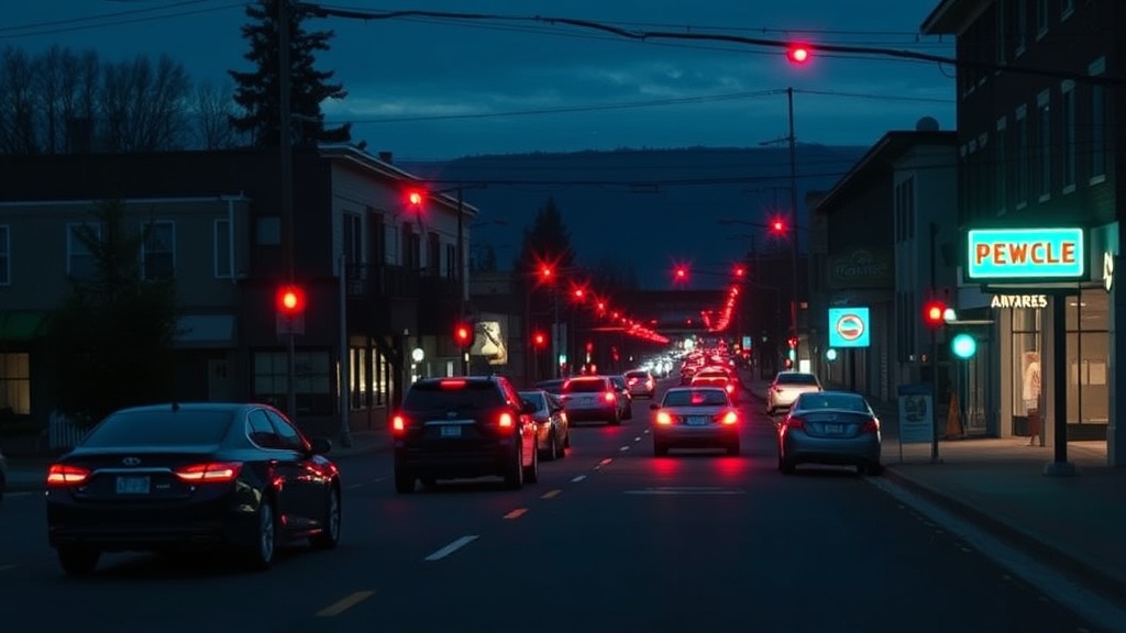
Port Alberni's Argyle Street serves as the main artery connecting the south end neighbourhoods to downtown—and everyone seems to need it at the same time. The morning rush hits hardest between 7:45 and 8:30 a.m., when workers head toward the mills, hospital staff change shifts at West Coast General Hospital, and parents drop children at École John Howitt Elementary and Alberni District Secondary School.
The bottleneck forms where Argyle narrows near the Somass River bridge, and again at the intersection with Redford Street. Traffic lights aren't synchronized through this stretch, which means you'll hit red after red if you don't time it right. Construction on side streets (common during our dry summer months) pushes even more vehicles onto Argyle, turning a ten-minute drive into twenty-five.
Weather plays a role too. Port Alberni's infamous rain—nearly 2,000 millimetres annually—slows everyone down. When the fog rolls in from the Alberni Inlet and sits in the valley, visibility drops and cautious drivers crawl along. Winter brings its own headaches, with leaves clogging drains on Johnston Road and ice forming on the bridge approaches.
What Are the Best Alternative Routes Around Argyle Street?
Seasoned Port Alberni drivers know Argyle isn't the only way through town. The key is understanding which alternatives work for your specific trip—and when to use them.
3rd Avenue and Redford Street Loop: If you're heading downtown from the south end, try cutting over to 3rd Avenue via Margaret Street. This residential route runs parallel to Argyle and feeds into Redford Street near the Capitol Theatre. It's quieter, has fewer stops, and you can usually find parking near the Port Alberni Friendship Center if you need to access the central business district. Watch for school zones though—speed limits drop to 30 km/h during bell times.
Kitsuksis Drive and the Highway 4 Bypass: For those traveling between the north and south ends of Port Alberni, Kitsuksis Drive offers a scenic alternative that skips Argyle entirely. Follow it past the Harbour Quay, connect to the Highway 4 bypass, and loop back via Roger Street or Gertrude Street depending on your destination. This adds distance but often saves time during the worst congestion—and you'll catch glimpses of the inlet that remind you why we live here.
Back Routes Through Cherry Creek: If you're coming from or heading toward Beaver Creek, River Road, or the communities west of town, consider taking the Pacific Rim Highway (Highway 4) and cutting down via Johnston Road or Hector Road. Yes, you'll deal with the single-lane sections, but you'll avoid the Argyle Street crawl entirely. The BC Ministry of Transportation maintains current road condition reports that are worth checking before committing to this longer route.
When Should You Travel to Avoid the Worst Congestion in Port Alberni?
Timing is everything when handling Port Alberni's street network. The morning rush peaks between 7:30 and 8:45 a.m., with a secondary wave around 9:00 a.m. when retail and office workers arrive. The evening rush starts earlier than you might expect—around 3:15 p.m. when Alberni District Secondary School dismisses, followed by the main wave between 4:30 and 5:45 p.m.
If your schedule allows flexibility, plan trips through the Argyle corridor between 9:30 a.m. and 2:30 p.m. Lunch hour (11:30 a.m. to 1:00 p.m.) sees increased activity, but traffic moves steadily. Saturday mornings bring their own challenges, especially when the Alberni Valley Farmers' Market operates near the Harbour Quay—though that's shifted to Roger Street, the overflow affects nearby intersections.
Sunday remains the quietest day for driving in Port Alberni, with most local businesses closed or operating reduced hours. Early mornings—before 7:00 a.m.—offer clear sailing regardless of the day, which is why contractors and shift workers at the Catalyst Paper mill often prefer those hours.
Practical Tips for Driving Port Alberni's Main Arteries
Beyond knowing the routes and timing, a few local habits will make your daily commute through Port Alberni less stressful.
Watch for Pedestrians: Our community is walkable, and people take advantage of that. Crosswalks at Argyle and Redford, Argyle and 10th Avenue, and near the library see heavy foot traffic. Drivers must stop for pedestrians at marked crosswalks—it's the law, and enforcement is active around school zones.
Plan for Train Delays: The railway crossing at Stamp Avenue can halt traffic for ten minutes or more when the Industrial Rail switch engines move freight. There's no schedule posted publicly, but locals know to check the tracks as you approach—if you see cars parked on the siding near the Eighth Avenue crossing, a train is likely coming. The City of Port Alberni website occasionally posts notices about planned rail maintenance that affects crossings.
Keep Fuel Topped Up: Running low on gas while stuck in Argyle Street traffic is a special kind of anxiety. The Chevron at Johnston and Redford, the Shell near the Highway 4 junction, and the Petro-Canada on Third Avenue are your main options—none of which are convenient to reach if you're already creeping along Argyle in the wrong direction.
Use Turn Signals Early: Port Alberni drivers are generally courteous, but sudden lane changes on Argyle cause cascade delays. If you need to turn left into the Shoppers Drug Mart parking lot or right onto Tebo Avenue, signal well in advance. The left turn lane at Argyle and Johnston backs up for blocks during rush hour—if you miss the advance green, you'll wait through another full cycle.
Parking Strategies Near the Argyle Street Corridor
Once you've handled Argyle Street, finding parking in downtown Port Alberni presents its own challenges. Street parking along Argyle itself is metered Monday through Saturday, 9:00 a.m. to 6:00 p.m., with a two-hour limit. The meters accept coins and credit cards, and the city is slowly rolling out app-based payment options.
Free parking exists if you know where to look. The lot behind the Capitol Theatre (accessible from Stamp Avenue) offers two-hour free parking and puts you within a block of most downtown businesses. The gravel lot near the old train station—now the Alberni Valley Museum—has free all-day parking, though it fills by 8:30 a.m. with courthouse and government office visitors.
For longer stays, the city operates a parkade off Eighth Avenue behind the Commonwealth Pool. It's rarely full, costs less than street meters for stays over three hours, and provides covered parking—valuable during our wet winters. The walk back to Argyle Street takes about three minutes, and you'll pass several local shops worth supporting.
Getting Around Without a Car in Port Alberni
Not everyone handling Port Alberni drives. The Port Alberni Transit System runs buses along modified routes that sometimes bypass Argyle Street congestion entirely. The #1 route connects North Port to the south end via Redford Street, while the #2 serves the Stamp Avenue and Johnston Road corridor. Fares are affordable, and monthly passes make sense if you commute regularly.
Cycling is increasingly popular here, though Argyle Street itself isn't the most bike-friendly route. The city has been improving cycling infrastructure, with dedicated lanes on Third Avenue and shared paths through Kitsuksis Creek Park. If you're comfortable on two wheels, you'll often beat car traffic during peak hours—and the mild climate means year-round cycling is realistic for most residents.
Walking remains the most reliable way to move through downtown Port Alberni, especially for errands within the core. From the Harbour Quay to the top of Argyle near the hospital is a twenty-minute walk—often faster than driving and parking during busy periods. Our compact city center means most services sit within a comfortable walking radius once you've reached the downtown area.
Living in Port Alberni means accepting that Argyle Street will sometimes slow you down. But with these routes, timing strategies, and local knowledge, you'll spend less time idling at red lights and more time where you're actually headed. The key is thinking like a local—knowing when the back way saves time, when patience beats shortcuts, and how our community's rhythms shape the streets we share.